Sunday, 29 July 2012

Twitter helps publicise walk


A BIG FAT MASSIVE THANK YOU to everyone who has tweeted about my walk and donated today!  Andy Nyman, Faisal Islam, Al Campbell, Dan Roan, Kate Silverton,


Robin Ince, Emily Maitlis, Rebecca Front, Helen Keen,  and many anonymous others - THANK YOU.

Some of you I can't thank personally as I don't have your details, but your donations and support is very, very much appreciated!

God bless Social Media!

Sunday, 22 July 2012

Itinerary Map and final route

Here is a map which shows where I will be stopping each day, and gives you a rough idea of where I am walking to each day.


And here is the final route with stops.  I know the mileages probably don't work out exactly but it gives you an idea. 


I have also finalised all the arrangements and am ready to go.  Going to try and fit one more practise walk in before I leave.  Two weeks to go . . . .

Sunday, 8 July 2012

Training Walk White to Dark Day 2 01.07.12

Today was a day I approached with excitement and a small amount of trepidation.  I knew I was going to miss Dave's company on the walk, but I was really excited about bagging Stanadge Edge and seeing the views from the top of Win Hill.

Here are some pictures from the day :-

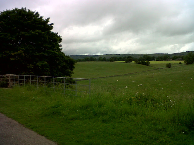
The view as I started my walk across the fields towards Hathersage.


The walk across farmland and through grassy fields was fun, with some mild ascents and descents.  I could soon see Stanadge Edge in the distance, and the imposing edifice got closer and closer as the path became steeper and steeper.  Sheep crossed the path as I came out of the trees and made my way across the last road before the Edge itself.


Animal enjoys the view from just below Stanadge Edge.

I kept stopping on the way up as the sun was shining and the views were epic, and it seemed like the whole of the peak district was opening up behind me.  After much huffing and puffing I made it up onto Stanadge Edge itself.  As soon as I broke over the top of the edge the wind hit me.  I consulted the map and quickly decided on my path.  It was at this point that the wind really got up, the temperature dropped and the rain set in (you know, that fine rain that soaks you through).  This rain accompanied me for pretty much the whole of the rest of the day.

As I made my way along the edge I decided to walk down to the path which runs just beneath the edge itself to take some shelter from the weather.  As I walked along I spotted hundreds of millstones, dotted about the landscape.  I had read that the edge was used a quarry for millstones in the 18th century and these must have been left when the quarry stopped production.  It was certainly an unusual sight as they were scattered about all over the place!


One millstone near here had been turned into a picnic table!


I also passed groups of what must have been DofE kids climbing the side of the edge.  The walk down off Stanadge Edge was long and more difficult than I thought it would be.  The weather, coupled with the extremely boggy ground meant it took a long time to get to the road.  Once on the road I met up with dad and sat in his dry and warm car to eat some lunch.  By the time I got down to Ladybower Reservoir the rain had cleared and the walk round the lake side and across the dam wall was very pleasant.  I could see Win Hill in the distance.

Win Hill ahead - last summit of the trail!
The trek up Win Hill was easy to follow but was the steepest trail of the walk, and with the wet conditions making it slippy, I had to take my time.  The forest broke near the summit and a stepped path led up to a craggy peak steep on all sides.  You could see for miles, and as I took it all in I could see the cloud descending and the spit spot of rain heading my way!  The wind whipped round me as I took in the view for a brief minute before heading off the top and making my way down the path.  The weather had closed in again just as I made it to the peak and the views were rapidly disappearing.

The path down from Win Hill was so steep in parts that I was not sure I could make it down without sliding down on my bottom!  I regretted deeply not bringing my walking poles, but carried on cautiously making my way down until I hit the road just outside Hope.  Then it was just a case of walking the road (which was ankle deep in water in some places) until I made it to the agreed rendezvous with my Dad at the Cheshire Cheese Pub on Edale Road.

We both enjoyed a well earned pint, before packing up and making our way back home.


Find the route plan for today's walk here White to Dark Day 2 Route Plan

Thanks to Dad for the bacon and eggs each morning and thanks to Dave for his support and excellent map reading skills! 

Training Walk White to Dark Day 1 30.06.12

And so it begins . . .

The day we started the epic traverse from the White Peak to the Dark Peak, Bakewell to Hope in two days.

My old friend, Dave Padgen, accompanied me on this day.  Check out his website here, he is a very inspiring chap! He is extremely supportive about my charity walk, and knowledgeable about the outdoors and has given me many tips which will benefit me when I complete the actual walk in August.  It was great to walk with someone and due to us both falling on our arses towards the end of this first day, he did not accompany me on Day 2.  I missed ya Dave!

The campsite was OK, with good facilities, but noisy up to 11pm at night due to groups of DofE kids getting their awards and the many families stying on site.  The site had a 'No noise' after 11pm policy, which most people seemed to obey.

The route was beautiful, we passed through some amazing countryside, rugged and desolate cliffs and valleys, and rolling farmland, criss-crossed by roads and dry stone walls.

We left early and started walking from the car park in Bakewell at about 7.45am.  The weather was generally good, but changeable, and there were many occasions where we stopped and took on / took off our coats / layers etc.  To quote Dave, "We caned the first 6 miles" and had to ease up on the pace a little for fear of 'running out of energy' at the end.

The pub at Foolow, The Bulls Head Inn, is a good quality pub, and do a nice line in cask ales and sandwiches, which we sampled for our lunch.  We met up with Dad at Eyam, by the museum, and after a few minutes rest continued our steep and arduous climb up to Eyam Moor.  


The last push over Eyam Moor and the heaving great rainstorm we walked through meant that the steep downhill descent that followed resulted in both of us falling on our behinds within the space of two minutes!  Dave bruised his hip, and after some considerable consideration and discussion, he decided not to come on the next day's walk - Dave is in training to climb Mount Elbrus in August and I did not want to jeopardise his expedition.

Here are some pictures from the day :-

The trail was well marked - good job as occasionally the map didn't exactly match up with the landscape!


The Monsal Trail - an easy path to walk, pretty flat, and stunning views.  This is the main reason we 'caned' the first few miles!

The Monsal Trail was probably the busiest trail we walked - plenty of serious walkers, dog walkers and cyclists.


The Headstone Tunnel - the path actually runs underground for a considerable distance.  Amazingly atmospheric!


. . .and 487m later, coming out the other side to emerge on .  . .

. . . The Monsal Viaduct, some 40 feet above the ground - amazing views.

We followed the path off the Monsal Trail and down into Cressbrook Dale, past this great weir!  Check out Dave's pictures of this water feature on his blog.
This was the gate we climbed over as we 'left' the field!  Thank god we didn't see the bull!

The view across the fields between Foolow and Eyam.  We passed through twelve small gates and eight squeeze stiles!


The instructions for the route, by Country Walking Magazine, can be found here  White to Dark Route Plan

One thing I feel slightly disappointed about is, if the route mapper is to be believed we did not walk as far as I had planned each day.  However, the ascents and descents were much more challenging that I had anticipated.

There were no MP3 tracks listened to on the way round, but I did play 'Raining in my Heart' on the Ukulele back at the campsite.

Dave has written an excellent blog about the first day with some cracking pictures.  Link below

http://stumbling.co.uk/bakewell-to-highlow-hall/

The map of the route, including elevation diagram, can be viewed here  White to Dark Day 1

Friday, 8 June 2012

Training Walk 08.06.12

I was expecting today's walk to be a tough one.  Heavy rain was forecast all afternoon and it was going to be the longest walk I've done so far.  As it turned out the heavy rain did not appear, although it did rain on and off all day.

I walked fast, trying to get a good pace going, and as most of it was on tarmac paths I was able to keep the pace up.  I made my fastest time over a mile yet, but it is clear that walking on hard tarmac paths and roads hurts my feet more!

The Church at Normanton

About to cross the dam - it was so windy.
Think the workmen were getting a bit fed up!

Lunch Stop!
The view across the meadow to Egleton
The reservoir is SURROUNDED by sheep
Spotted a helicopter today, but couldn't make out what sort it was.


You may notice there is a picture of Animal from the Muppets above.  He is now my mascot, and will come with me on every walk I do.  I'm going to try to take a picture of him somewhere on each walk. Today I stopped for lunch in a hide at the Anglian Water Birdwatching Centre and Animal sat with me.  After lunch, a woman who was birdwatching in the hide offered me her binoculars and showed me how to spot a Goldfinch. 

One thing I found annoying was the signposts dotted along the path around the reservoir - I think that most of them were wrong!  Along the north shore I passed a signpost that said 'Egleton 3 miles', walked for at least another mile or two and then saw another sign which said 'Egleton 3 miles'!  

Check out the route here

Training Walk 08.06.12

I listened to Radio 4 for most of the walk, until my battery ran out!  The ukulele song played when I got home was 'Everything's Not Lost' by Coldplay. 

Monday, 4 June 2012

Training Walk in Derbyshire


The BIG Training Walk is now on!  Friday 29th June to Sunday 1st July, myself, my Dad and my friend, Dave Padgen, are all going to Derbyshire to walk nearly 30 miles in two days.  We'll be camping out and doing a 'dry run' for the Coast to Coast in August.

As some of you may know, Dave is an experienced adventurer, climber and has taken part in expeditions around the world, so my little jaunt should be nothing to a man of his calibre!  He has been really supportive and taken me on a practice walk up Mam Tor already.  It will be great to have some company whilst out on the moors and hills of the White and Dark Peaks.

Our walk will follow a new route only recently created called 'White to Dark'.  Starting in Bakewell, we will walk north, from the White Peak, all the way to Hope and Ladybower Reservoir.

The campsite is almost booked, and it'll be a great opportunity for me and Dad to get a sense of what it will actually be like when we go to the Lakes in August.  It'll also be a good chance to get Dad used to all the gear and me used to walking in unfamiliar places and relying on the maps more.

More news to come about the training walk - keep checking back!

Check out Dave's website here Stumbling Adventures

Route information for White to Dark on Country Walking website


Route plan for White to Dark (PDF)

Latest NEWS

Thanks for keeping up to date with the blog everyone.  Latest news is that we have been mentioned in 'The Forest' magazine - click on the link at the bottom of this post to see the story online.

And, look out for future stories about the Coast to Coast in other local news media.

Thanks everyone!

Gary's C2C in The Forest

Banner